

🗺️ The route
Free to viewYou have seen the route. Take it to Komoot or your GPS watch so you are not following a phone signal you might not have.
Join free to downloadAs one of the highest points in Nottinghamshire, this walk through Silverhill country park and upto the ‘testing for gas’ statue is a great option for anyone who’s looking for an easy walk with something a little different to see.

What to expect
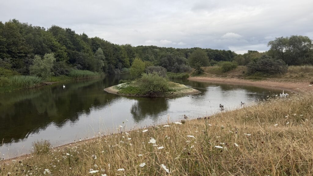
The paths and trails through the park are very good and easy to follow, there are many different routes you can take here depending on the distance and elevation you’re looking for. Head straight to the ponds on the lower path or the higher route will take you to the statue gibing you great views across the Nottinghamshire countryside.
This route joins on to the Phoenix Greenways trail which is a multi user path and will take you for miles all around Nottinghamshire and into Derbyshire.


Getting there & parking
Park at the main Silverhill Country Park car park – NG17 3JL. It’s a free car park and there’s space for about 20 cars here. There is more on street parking outside it is full when you visit, although its unlikely to be.
Good to know
You'll find free parking at the start of the walk. Postcode for sat nav: NG17 3JL.
No, there aren't any on this route.
Yes, dogs are welcome on this walk.
Expect woodland paths underfoot. What we wear for it ↓
The route
- 1.8 Mile
- 1 Hour
- Easy
We left the car park and headed up the hill before taking the path to the left, this looped around and upto the statue. From here we continued right back down the hill before turning left at the bottom towards the ponds, we headed back along this same track after a quick cuppa on one of the picnic benches.
Step-by-step
- From the car park, head into the country park and up the hill.
- You will reach a fork in the trail, head left here.
- Follow this path through the woodland and up the hill.
- You will see the 'Testing for gas' statue on your right after a short while, follow this path upto it.
- After enjoying the view and reading the plaque here, head down the hill the other side and to the right.
- You'll go through a gateway, joining the multi user section.
- At the bottom here, turn left and head towards the ponds.
- There are 2 ponds with picnic benches on the banks.
- Enjoy a sit, drink or picnic here before heading back on the path you came.
- This time don't head upto the statue but stick with the lower path.
- This will take you back to your car.
Heading out? Take this walk with you
Free members get the tools to follow it on the day, so you're not relying on phone signal.
- GPX downloadFor your phone, watch or Komoot.
- Printable route cardOne page with the route, pit stops and an emergency line.
- Track it & earn badgesTick it off and add the miles to your log.


Tips & what to bring
This is the perfect spot for a dog walk or picnic with many picnic benches placed around the ponds.
What we'd pack for this walk
See how we wear it →Kit we actually use, picked for this route.
-
Our everyday pick We both wearLa Sportiva TX4
Grippy, supportive approach shoe we wear on rockier Peak trails.
-
Always in the pack Ads wearsRevolutionRace Waterproof Jacket
Bright, fully waterproof shell for proper British weather. Ads' go-to in the orange.
-
Room for water & snacks Char usesDeuter Speed Lite 23
Lightweight, low-bulk pack for fast, lighter days.
Eat & drink nearby
Hardwick Inn is a short drive down the road, if you want more choices the town of Mansfield and the Designer Outlet village are both about 10 minutes away, by car.

Places to stay nearby
More walks near here


Never Miss a Walk
New routes, hidden gems and honest reviews, straight to your inbox.